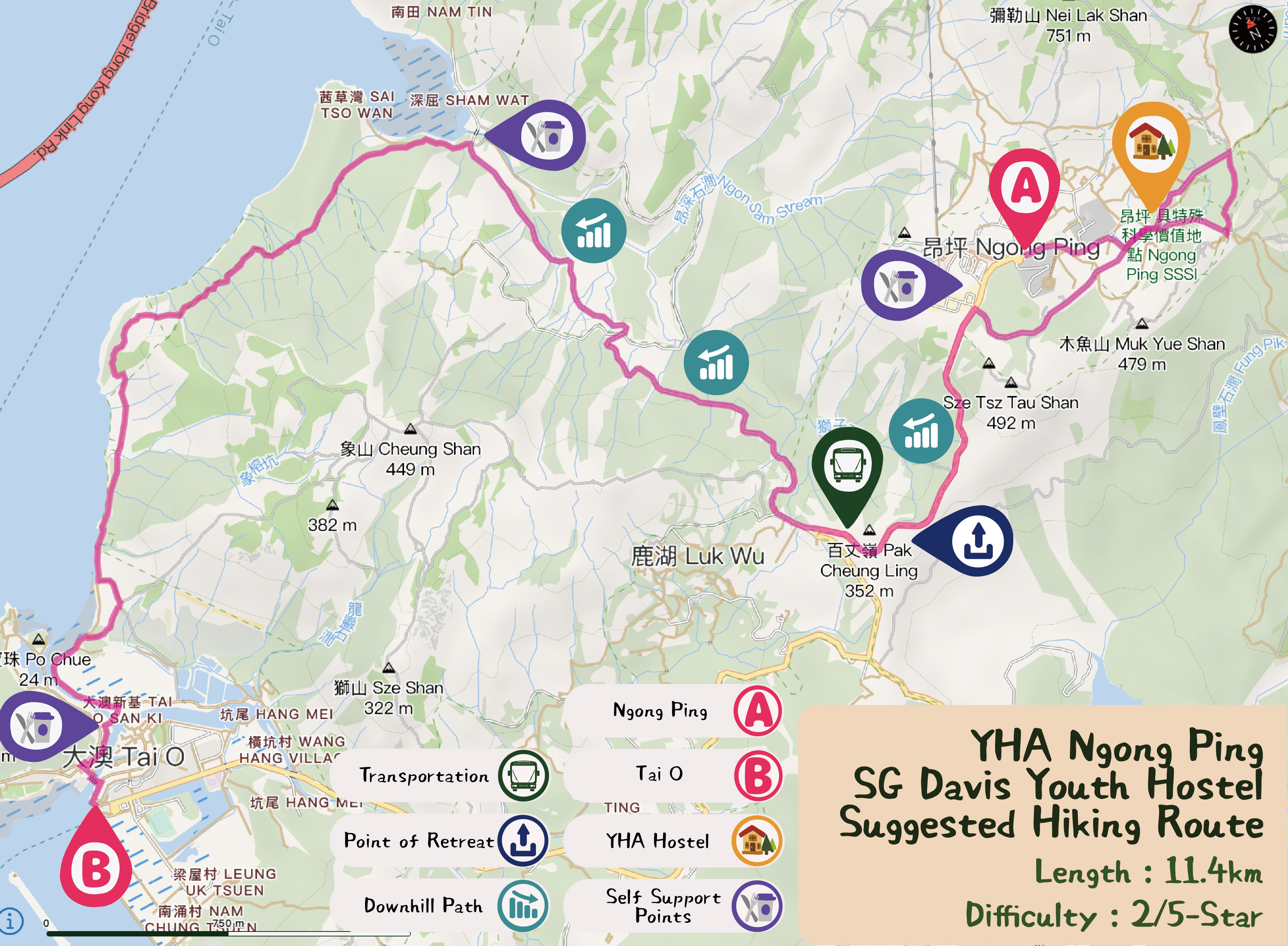
Suggested Routes
Trail and Distance: Ngong Ping (A) →Tai O (B), Around 11.4 km
Difficulty: 2/5 Stars🌟
Trail Description:
Take Bus route 23 from Tung Chung to Ngong Ping and set off the hike at Ngong Ping Piazza. You can see the century-old Po Lin Monastery and Big Buddha from a distance in the direction of Wisdom Path. After passing YHA Ngong Ping SG Davis Youth Hostel, walk along the pavement to Sham Wat Village. It’s mainly downhill walking, along which you can see different mountains at Lantau Island, such as Kwun Yam Shan and Cheung Shan. You can also get resupply and have a quick meal at Sham Wat No.7 or Sham Wat Village Tea House. After that, carry on along Tung O Ancient Trail to Tai O where you can enjoy the beautiful coastline.
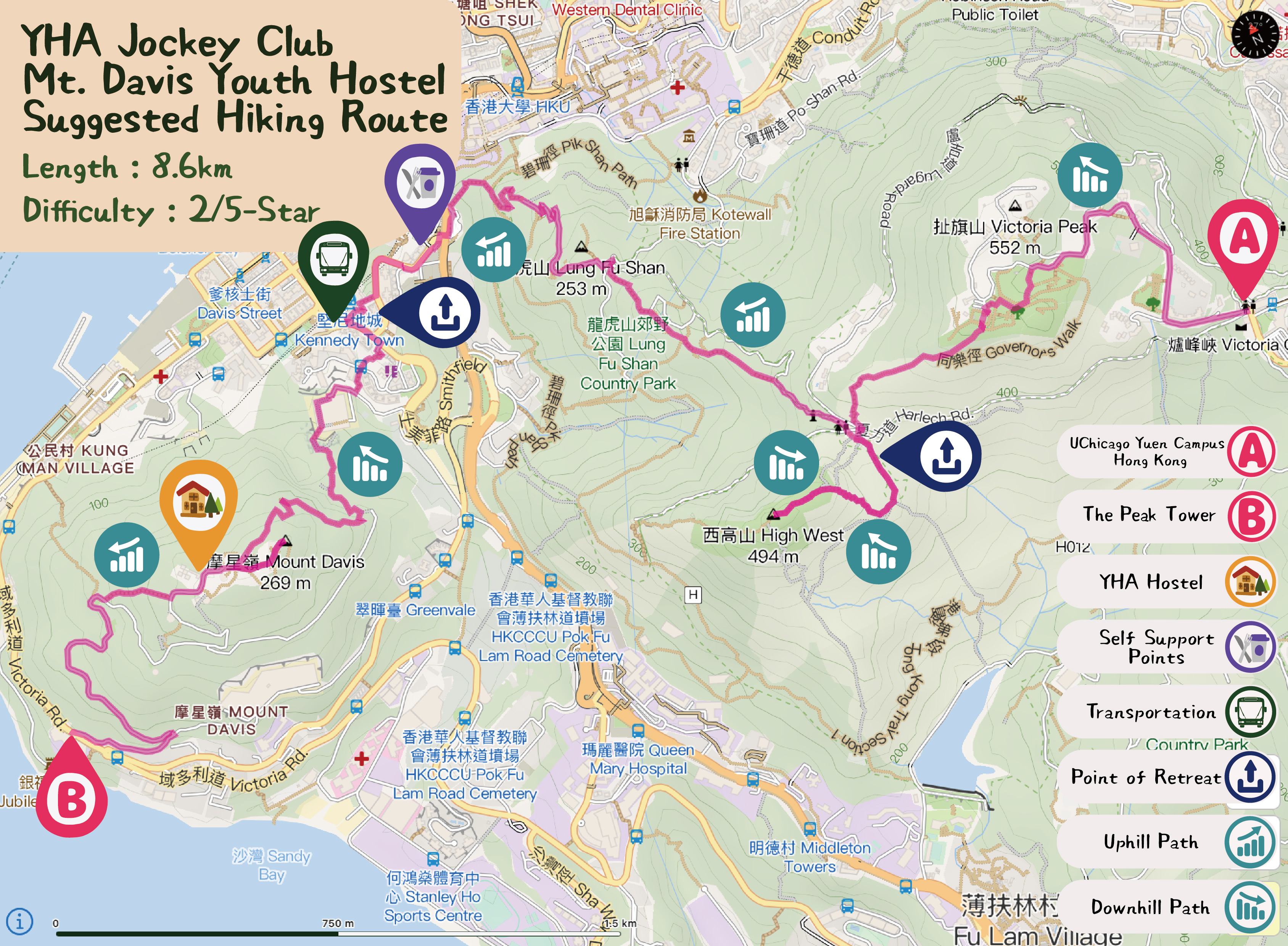
Trail and Distance: Peak Galleria (A) →Mount Davis (B), Around 8.6 km
Difficulty: 2/5 Stars🌟
Trail Description:
Take Bus route 15 to Peak Galleria and start walking at Victoria Peak Garden to Harlech Road. After passing the pavilion and street sign, turn left to reach High West. Walking up the mountain, you can overlook the scenic view of Pokfulam and Lamma Island. Later, walk down the slope, pass the Pinewood Battery, and turn to the direction of Kennedy Town where you can climb up to Lung Fu Shan View Compass at Kennedy Town Temporary Recreation Ground. You will pass YHA Jockey Club Mt. Davis Youth Hostel during the uphill walking. At last, walk downhill to the University of Chicago Francis and Rose Yuen Campus to end the trip.
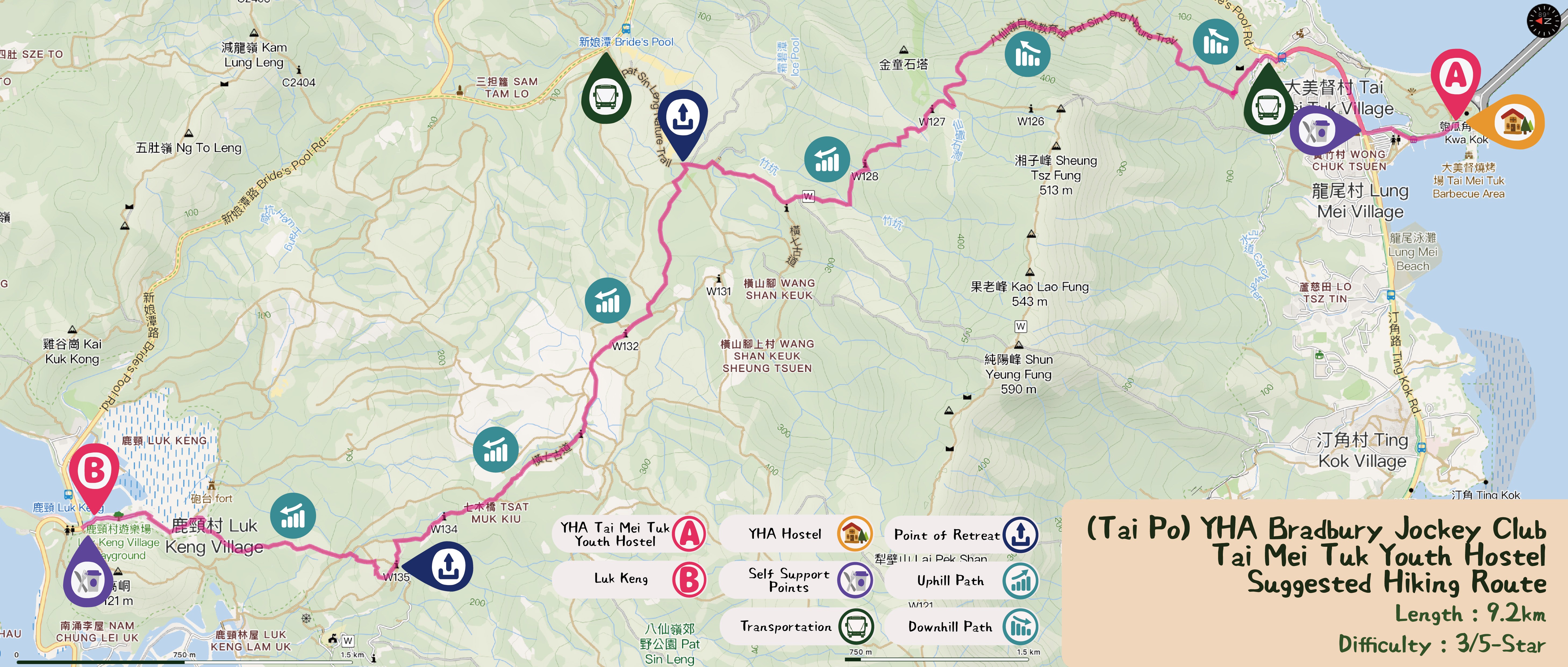
Trail and Distance: Tai Mei Tuk (A) →Luk Keng (B), Around 9.2 km
Difficulty: 3/5 Stars🌟
Trail Description:
Take minibus route 20C to Tai Mei Tuk at Tai Po MTR station and get ready at YHA Bradbury Jockey Club Tai Mei Tuk Youth Hostel. Then, walk along Ting Kok Road and pass the Spring Breeze Pavilion to reach Pat Sin Leng Nature Trail where you can enjoy the views of Plover Cover Reservoir from afar. Carry on along Wilson Trail Section 10 to reach Luk Keng and have some refreshments to end the trip.
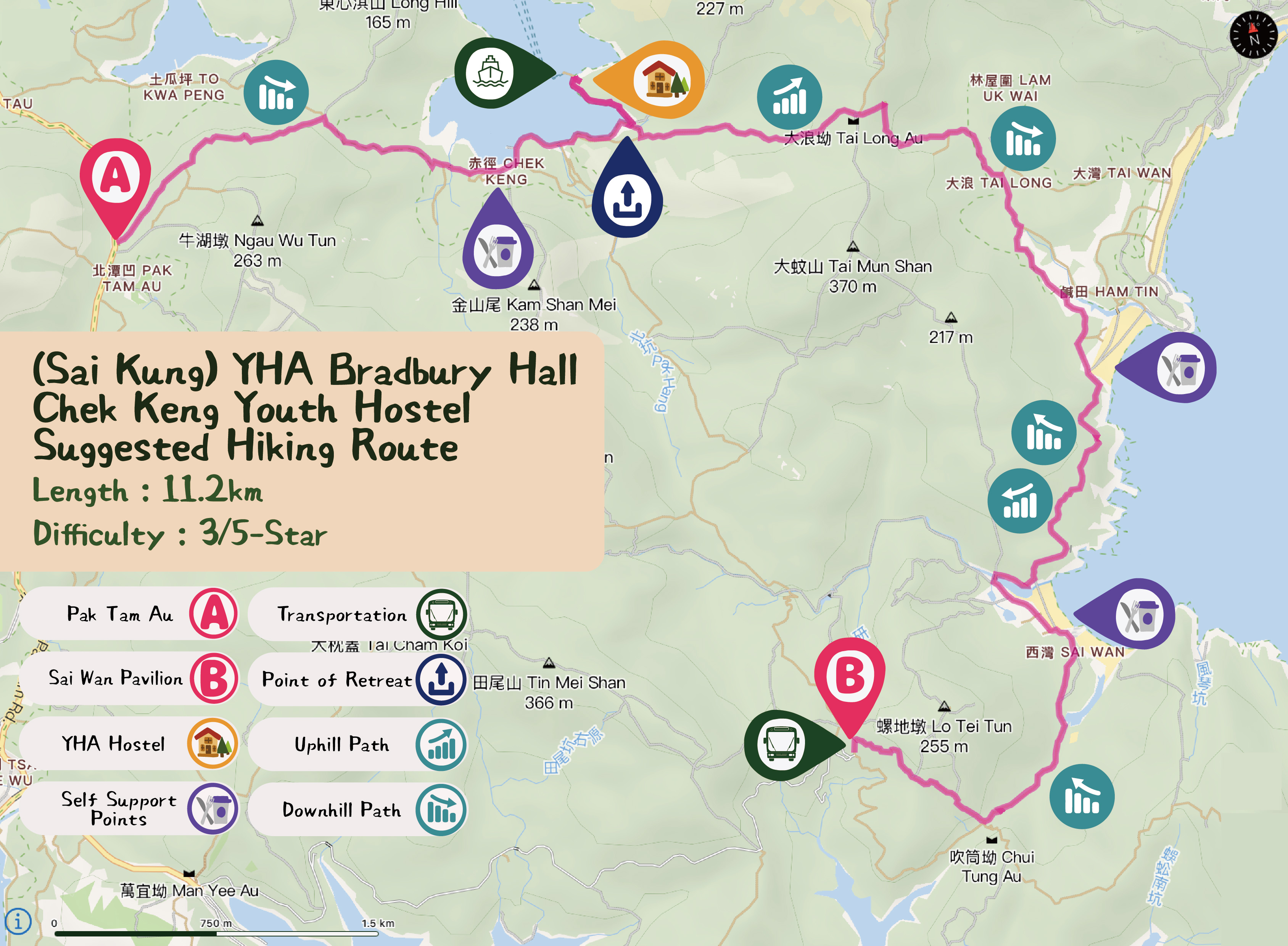
Trail and Distance: Pak Tam Au (A) →Sai Wan Pavilion (B), Around 11.2 km
Difficulty: 3/5 Stars🌟
Trail Description:
Take bus route 94 to Wong Shek Pier at Sai Kung town center and get off at Pak Tam Au station. There are toilets, drinking fountain and vending machine at the starting point. Walk along MacLehose Trail Section 2, go downhill to reach Chek Keng Village and pass YHA Bradbury Hall Chek Keng Youth Hostel. Then, walk uphill to Tai Long Wan and walk down the slope to enter the most beautiful section of MacLehose Trail, where offers you the panoramic view of Ham Tin Wan, Tai Wan and Sharp Peak. There are many kiosks for resupply along the way. At last, walk up the hill to Chui Tung Au and you can see Sai Wan Pavilion where you can take the shuttle of Sai Wan Village.
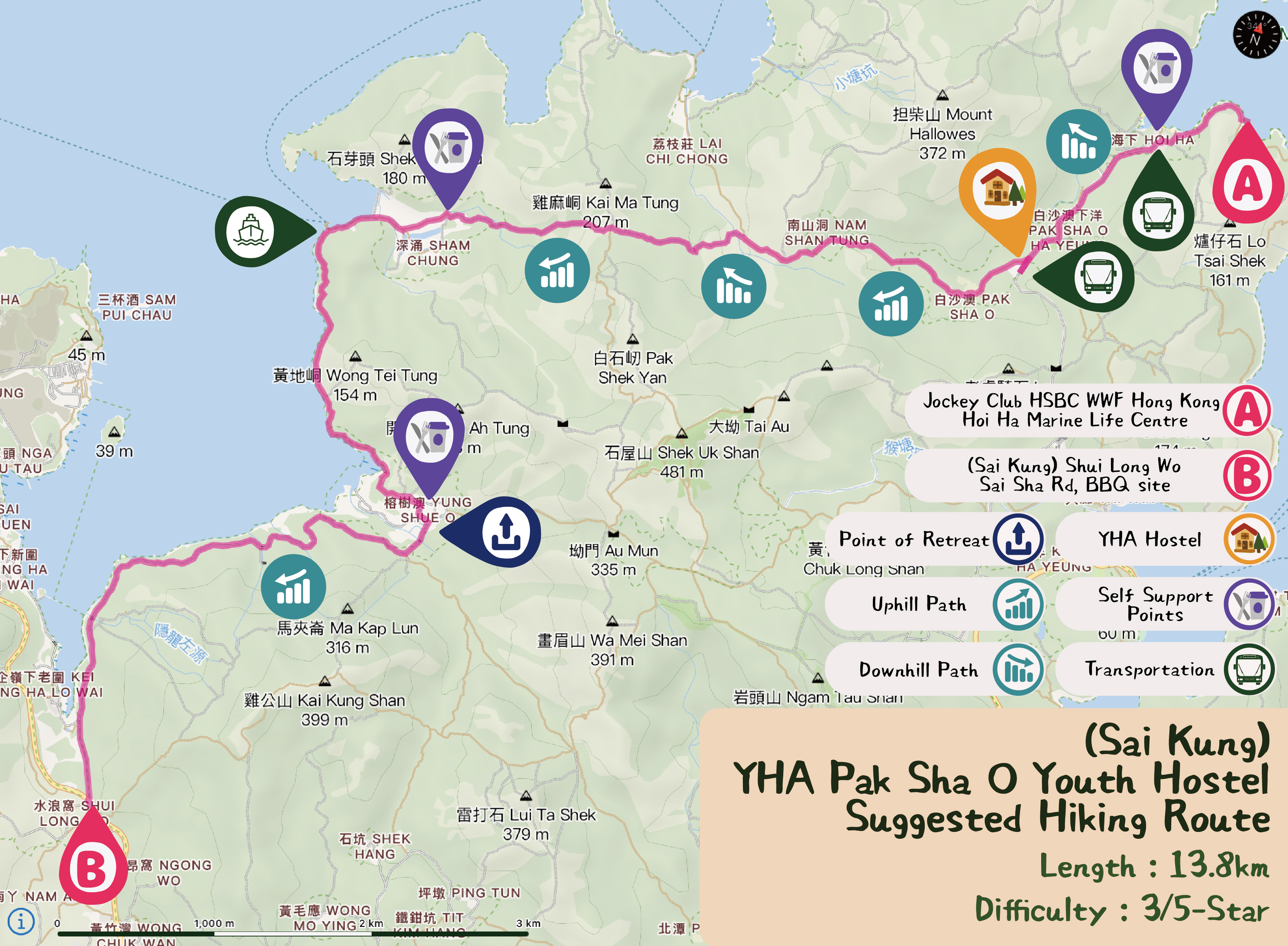
Trail and Distance: Hoi Ha (A) →Shui Long Wo (B), Around 13 km
Difficulty: 3/5 Stars🌟
Trail Description:
Take minibus route 7 at Sai Kung town center to Hoi Ha and then enter the concrete path after you see YHA Pak Shak O Youth Hostel at Hoi Ha Road. Walk to She Shek Au via Ha Yeung and Nam Shan Tung. The route is rather rugged with a muddy path near Nam Shan Tung in the middle section. Continue go downhill, walk past an old church and proceed to Sham Chung, where you can see the vast grassland. Walk along the coastal path which leads to Yung Shue O through an area of mangroves. Then walk along the catchwater to Shui Long Wo while taking in the wonderful sunset views over Kei Ling Ha hoi and reach Shui Long Wo Viewpoint to end the trip.
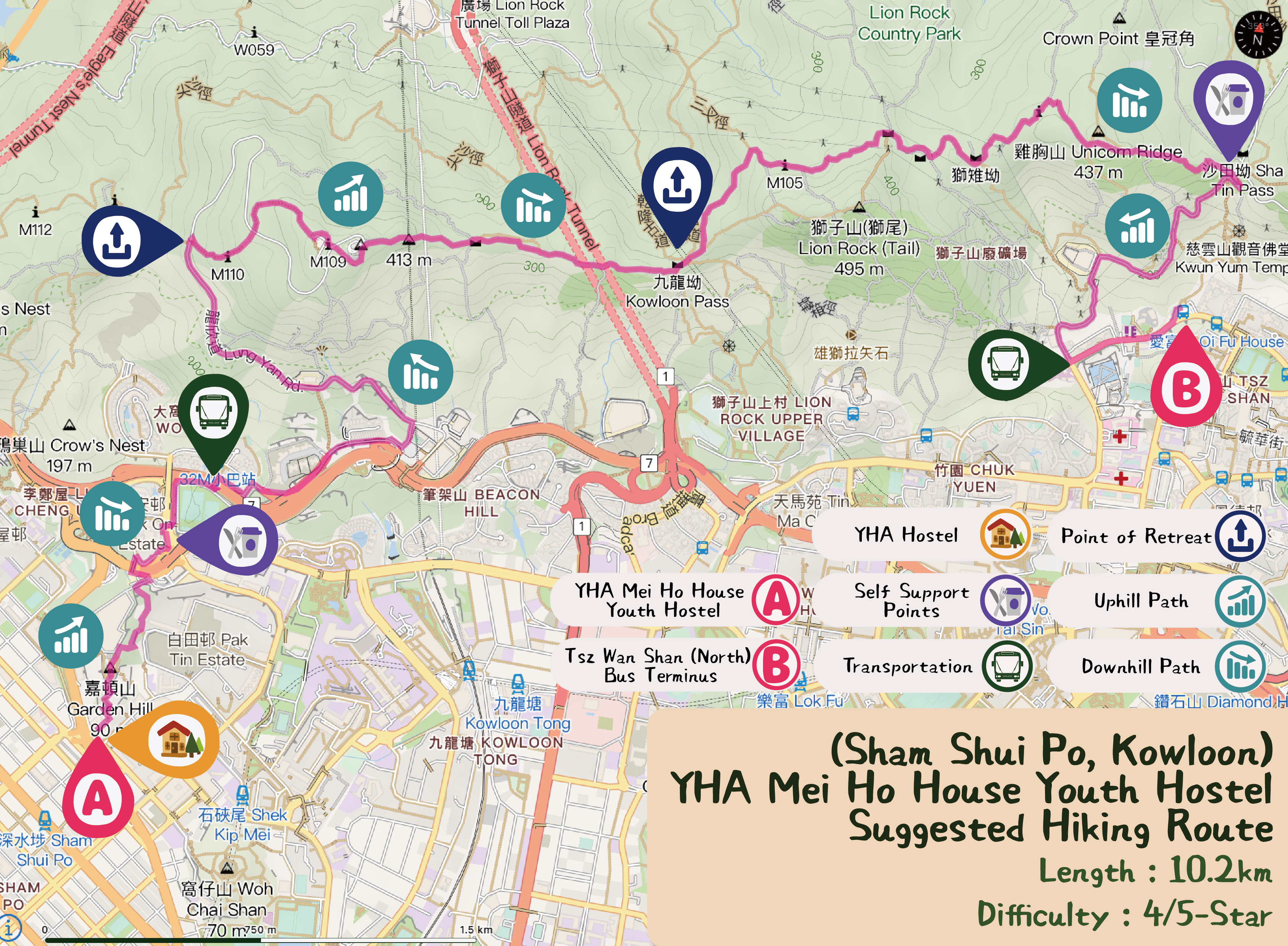
Trail and Distance: Sham Shui Po (A) →Tsz Wan Shan (B), Around 10.2 km
Difficulty: 4/5 Stars🌟
Trail Description:
Starting from YHA Mei Ho House Youth Hostel near Sham Shui Po MTR station and climb up Garden Hill. Then, walk downhill to Pak Tin Estate and carry on along Lung Cheung Road, pass Shek Kip Mei Service Reservoir Playground to Lun Yan Road. Go up Beacon Hill, then walk along MacLehose Trail Section 5 to Sha Tin Pass, pass the Reunification Pavilion and Lion Rock where you can enjoy the panoramic view of Kowloon. You can get resupply at Sha Tin Pass and then walk downhill to Tsz Wan Shan Bus Terminus to end the trip.
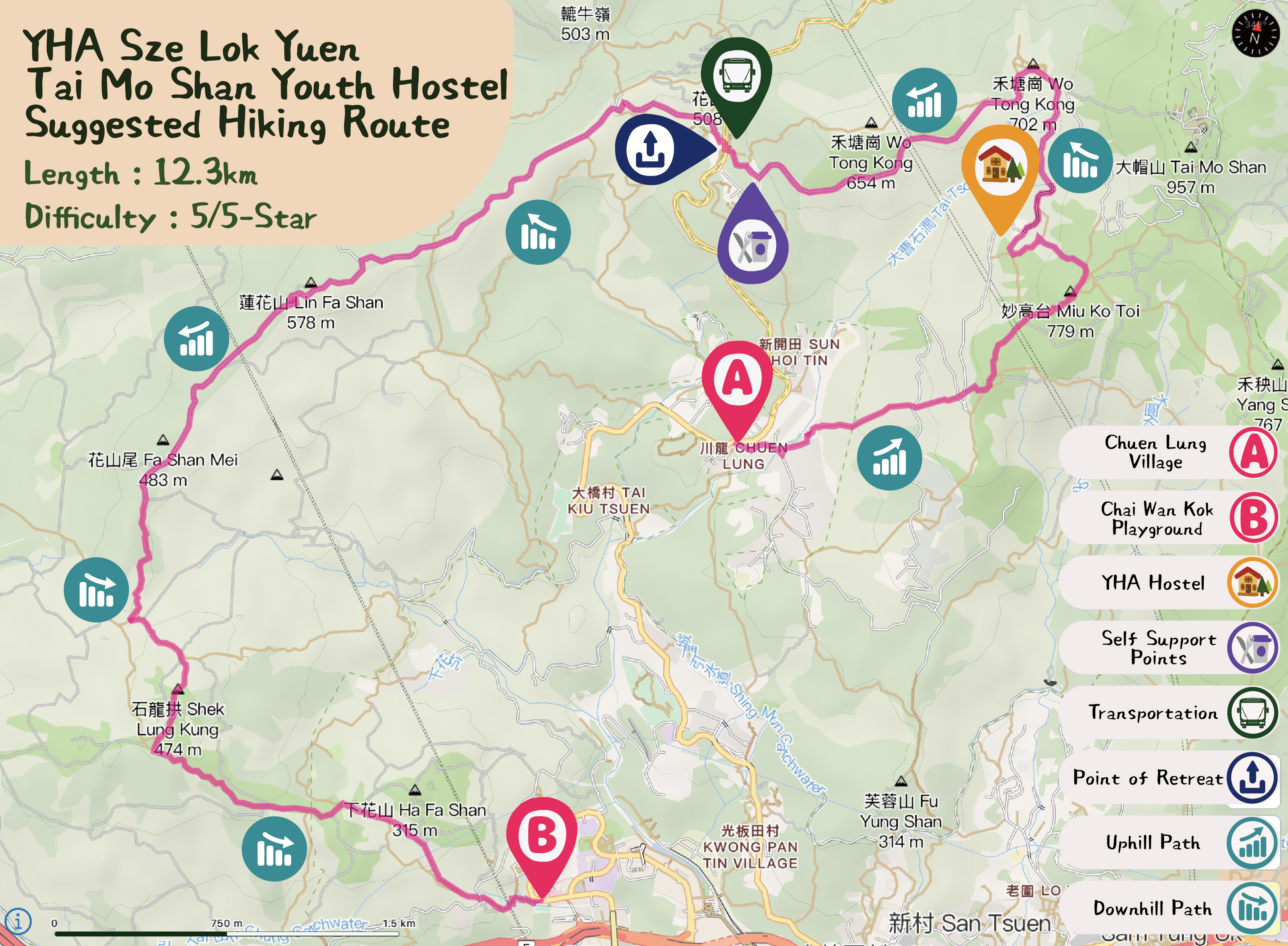
Trail and Distance: Chuen Lung (A) →Allway Gardens (B), Around 12.3 km
Difficulty: 5/5 Stars🌟
Trail Description:
Take minibus route 80 from Tsuen Wan to Chuen Lung and have dim sum at the traditional Chinese Teahouse in the mid-level of Tai Mo Shan. After that, walk uphill to reach Miu Ko Toi and the fire lookout where you can find YHA Mei Ho House Youth Hostel. Then, continue walking up to Tai Mo Shan Viewing Point where offers you the scenic view of Hong Kong. Later, you can get resupply at visitor center or Aunt Lin Refreshment Kiosk down the hill. After passing bus station 51, turn to MacLehose Trail Section 9 to Lin Fa Shan and Shek Lung Kung, where you can overlook the view of Tsuen Wan, Tsing Yi and Tsing Ma Bridge afar. The trip ends at Allway Gardens.
